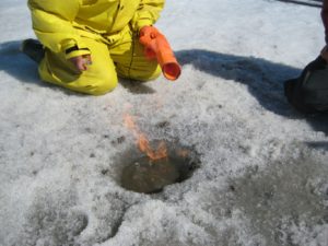
Methane escapes from a hole drilled through lake bottom sediment (photo credit: Z. Braul)
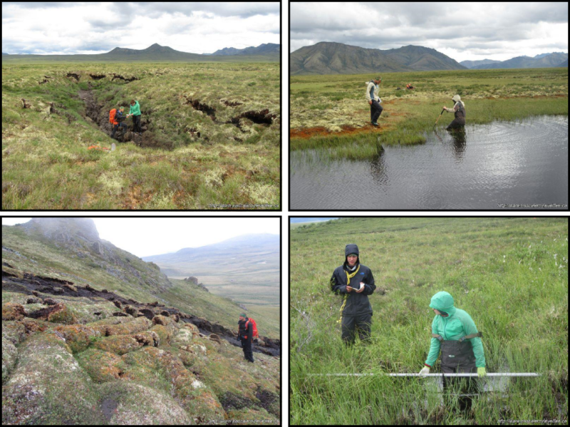
A paper published by Roy-Leveillee and Burn (2017) in the Journal of Geophysical Research- Earth Surface reports observations of permafrost degradation and talik development beneath water depths less than 15% of the maximum ice thickness in lakes of Old Crow Flats, northern Yukon. This is surprising as, in the near-shore zones of thermokarst lakes, it is generally assumed that permafrost is sustained where water depth is less than 60% of the local maximum ice thickness.
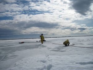
Jet-drilling to delineate the talik permafrost boundary (Photo credit: P. Roy-Léveillée)
The paper investigates controls on permafrost degradation and reveals that sub-lake permafrost is sensitive to on-ice snow distribution where the water column freezes through. It shows the importance of the thermal offset where conditions are marginal for talik initiation and highlights the role of interannual variability for prompt talik initiation near receding shores.
These findings improve understanding of permafrost degradation beneath shallow water, a topic of particular concern in the context of climatic warming as methane release from thaw lakes is concentrated near receding lake margins and is most active at the thaw front beneath the lake bottom.