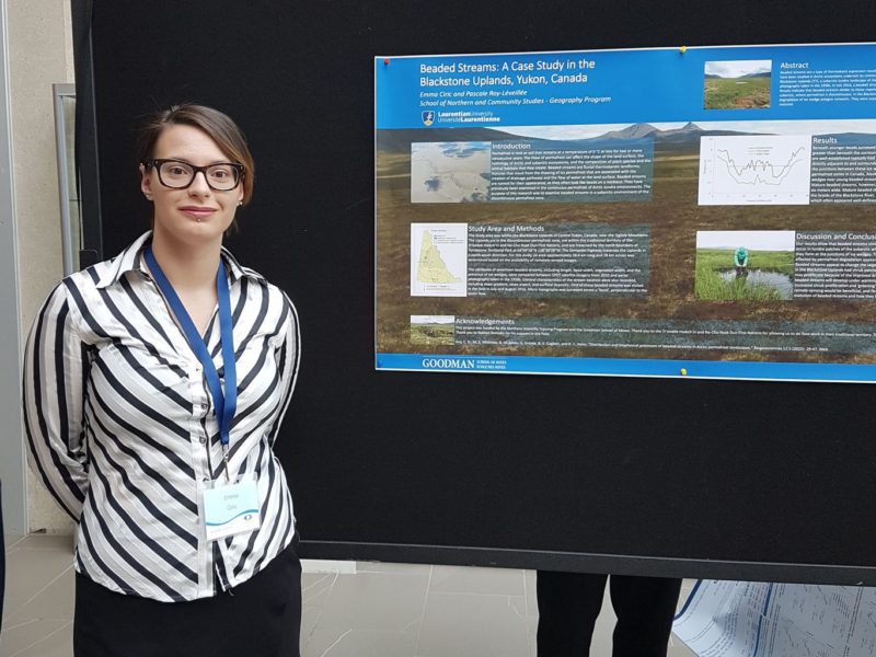
On June 1st, 2017, Emma Ciric presented her research on beaded streams at the Canadian Association of Geographer Annual Meeting at York University. Her poster was very well done, particularly for a first poster (!), and can be viewed here. Emma has now graduated from Laurentian University and went on to pursue a MSc in Coastal and Marine Science at the University of Algarve, in Portugal.
You are browsing archives for
Category: Periglacial Geomorphology
Permafrost teaching lab: Doug’s scale model of oriented lakes
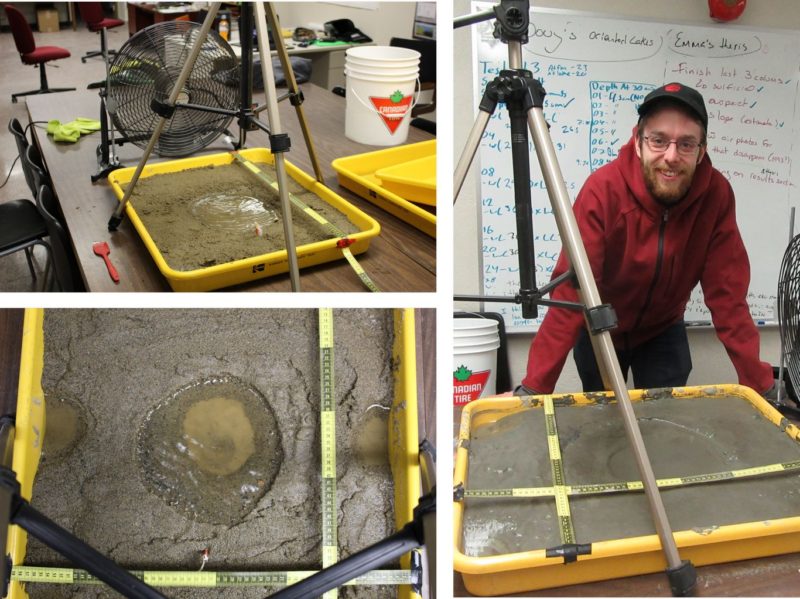
Douglas Massel is an undergraduate student from the LU Outdoor Adventure Leadership (ADVL) Program. Potentially interested in pursuing a career as a field technician for research expeditions in remote areas, Doug added a minor in Geography to his ADVL degree, and focused on physical geography courses. In the permafrost class this year, Doug is writing his term paper on the orientation of thermokarst lakes. He added a scale model experiment to his paper, to examine the hypothesis that sediment texture affects the direction of lake elongation in relation to dominant winds, as proposed in Roy-Leveillee and Burn, 2015. Doug has been busy in the lab blowing wind over trays of wet sand and silt with puddles in them to look at circulation and lake expansion patterns.

Doug’s scale model: wind is blowing (upper left), sediment is moving (bottom left), Doug is watching his lake expand.
In summer 2017 Doug will be working as a field assistant in the Canadian NW Arctic with Chris Burn from the Carleton Permafrost Group. Best of luck Doug, and send some photos!
New conceptual model for the genesis of drained thermokarst lake basin topography

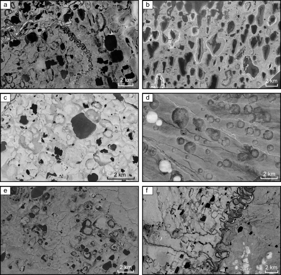
Examples of drained thermokarst lake basins with wet, depressed margins and drier ground near the basin centre (all pictures from Google earth): a) Fish Creek Area, Alaska; b) Tuktoyaktuk Peninsula, Northwest Territories; c) N Seward Peninsula, Alaska; d) Dewey Soper Bird Sanctuary, Baffin Island, Nunavut; e) Ayon Island, Chukotka, Siberia; f) Penzhina River area, Kamchatka Krai. Figure 2.6 from Roy-Leveillee, P. (2014) Permafrost and thermokarst lake dynamics in the Old Crow Flats, northern Yukon, Canada. Ph.D. Thesis, Carleton University: Ottawa, Canada.
A paper published by Roy-Leveillee and Burn (2016) in Earth Surface Processes and Landforms presents a new geomorphological model for the drained basin of thermokarst lakes in tundra areas.
Drained lake basins are widespread in Arctic lowlands affected by thermokarst and, in tundra areas, the topography of these basins typically constitutes a wet, depressed margin surrounding a slightly elevated, better drained centre. This low grade geomorphological feature is widespread in Arctic lowlands (see satellite images to the right), yet the genesis of this topography is poorly understood.
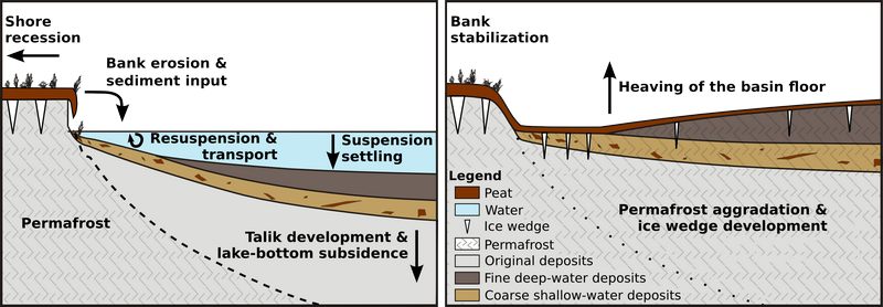
Based on conditions observed in Old Crow Flats, this new model suggests that patterns of sediment deposition along the lake bottom during lake expansion is what causes the raised centre and depressed margins revealed once permafrost is re-established in the drained basin floor (see diagram below).
This new model differs from that presented by Jorgenson and Shur based on observations of conditions in drained basins of the Alaska Coastal Plain. Their model relied on the poor frost-heave potential of gravelly sand which may accumulate near shore and the influence of shallow littoral terraces on permafrost configuration beneath lakes. This model raises the problem of equifinality, as similar topography develops in areas such as Old Crow Flats, where lakes lack littoral shelves and develop in fine-grained glaciolacustrine silts (no sand or gravel).
This new conceptual model relies on a mechanism that is applicable in any location where lake shore bank erosion leads to the redistribution of sediment by wave action along the lake bottom. Differences in ground ice content may accentuate the elevation differences between basins and margins in some areas, as reported from the Beaufort Coastal Plain, but it did not in Old Crow Flats.

Conceptual model of sedimentation patterns during thermokarst lake expansion (left) and resulting topography after lake drainage and permafrost aggradation (right). Sediment deposits that are in permafrost are marked with a light grey pattern. From Roy-Leveillee and Burn 2016, Fig 15.
