
Presentation on carbon input from lakeshore erosion at the 11th International Conference on Permafrost in Potsdam, Germany

Group photo for the 11th ICOP, in July 2016 (Credit: Alfred-Wegener-Institut/Jan Pauls)

Group photo for the 11th ICOP, in July 2016 (Credit: Alfred-Wegener-Institut/Jan Pauls)


The eleventh International Conference on Permafrost was held from June 20th to 24th in Potsdam, Germany. The conference was well attended with nearly 800 permafrost scientists and engineers, including many young permafrost researchers.


Eroding bank of a thermokarst lake in Old Crow Flats, Yk.

Eroding bank of a thermokarst lake in Old Crow Flats, Yk.

Pascale presented on the rates of organic carbon input in thermokarst lakes due to the erosion of shorelines in a tundra area of Old Crow Flats.This topic will be addressed in an up-coming paper co-authored with Elyn Humphreys, Zoe Braul, and Chris Burn. Preliminary results indicate that, in the area examined, approximately 0.22 teragrams of organic carbon fall in thermokarst lakes every year due to the erosion of the shorelines, including approximately 0.15 teragrams of organic carbon that was previously stored in permafrost.

Goodman School of Mines invests in permafrost studies at Laurentian University

The  Goodman School of Mines announced via its executive director, Dr. Bruce Jago, that it will be making a significant investment in a new permafrost laboratory and permafrost science training at Laurentian University over a period of three years. This training aims to give students the opportunity to gain practical field-based and laboratory-based experience in permafrost science, and to graduate with cutting-edge, concrete, and marketable field and laboratory experience in permafrost assessment and monitoring.

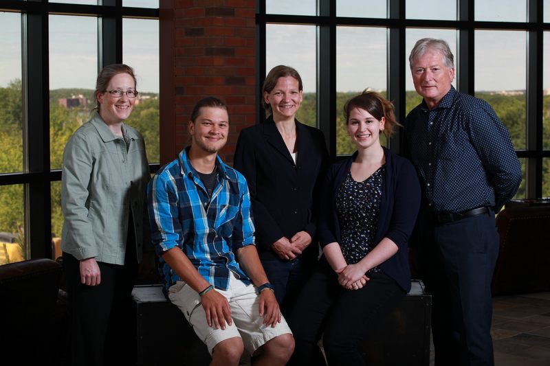
Left to right: Dr. Elizabeth Dawes (Dean, Faculty of Arts), Nathan Romahn (student), Dr. Pascale Roy-Léveillée (Assistant Professor of geography) Krystal Siebert (student), and Dr. Bruce Jago (Executive director, Goodman School of Mines).

Laurentian University students are already directly benefiting from this support. Emma Ciric will be traveling to central Yukon this summer to investigate controls on rates of permafrost degradation in the Blackstone Uplands as part of her undergraduate thesis in Geography. Nathan Roman will be joining her for his ADVL internship, to gain practical experience working as a technician and logistics coordinator for research and monitoring activities in remote areas. Krystal Siebert is working on a GIS-based project related to permafrost degradation and organic carbon. At least two other students are scheduled to begin graduate and undergraduate theses in 2017, and we are hoping several other students will be joining our team in the coming year.

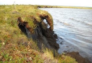
Laurentian University, with its long-standing relationship with the mining industry and its proximity to the Hudson Bay Lowlands, is in a strategic position to respond to the increasing demand for skilled permafrost technicians, consultants, and scientists resulting from increased infrastructure development in the Canadian Arctic and Subarctic.  In these regions, the ice content and temperature of underlying permafrost can be major concerns for infrastructure development, waste disposal, water contamination risk assessment, environmental monitoring, and site recovery.

The new permafrost laboratory, a new 4th year permafrost course (GEOG4256), directed studies on permafrost issues, and related undergraduate thesis projects will be housed in the School of Northern and Community Studies, within the Faculty of Arts. Graduate thesis projects will take place within the MSc Biology and the PhD Boreal Ecology programs. These courses and projects will be supervised by Dr. Pascale Roy-Léveillée, a new Laurentian University faculty member specialized in permafrost science who was appointed as assistant professor of Geography in January 2015, was appointed as adjunct professor in Biology in April 2015, and became a member of the Laurentian University Cooperative Freshwater Ecology Unit in April 2016.

New conceptual model for the genesis of drained thermokarst lake basin topography


6basins_100dpi

Examples of drained thermokarst lake basins with wet, depressed margins and drier ground near the basin centre (all pictures from Google earth): a) Fish Creek Area, Alaska; b) Tuktoyaktuk Peninsula, Northwest Territories; c) N Seward Peninsula, Alaska; d) Dewey Soper Bird Sanctuary, Baffin Island, Nunavut; e) Ayon Island, Chukotka, Siberia; f) Penzhina River area, Kamchatka Krai. Figure 2.6 from Roy-Leveillee, P. (2014) Permafrost and thermokarst lake dynamics in the Old Crow Flats, northern Yukon, Canada. Ph.D. Thesis, Carleton University: Ottawa, Canada.

A paper published by Roy-Leveillee and Burn (2016)  in Earth Surface Processes and Landforms  presents a new geomorphological model for the drained basin of thermokarst lakes in tundra areas.

Drained lake basins are widespread in Arctic lowlands affected by thermokarst and, in tundra areas, the topography of these basins typically constitutes a wet, depressed margin surrounding a slightly elevated, better drained centre. This low grade geomorphological feature is widespread in Arctic lowlands (see satellite images to the right), yet the genesis of this topography is poorly understood.

Based on conditions observed in Old Crow Flats, this new model suggests that patterns of sediment deposition along the lake bottom during lake expansion is what causes the raised centre and depressed margins revealed once permafrost is re-established in the drained basin floor (see diagram below).

This new model differs from that presented by Jorgenson and Shur based on observations of conditions in drained basins of the Alaska Coastal Plain. Their model relied on the poor frost-heave potential of gravelly sand which may accumulate near shore and the influence of shallow littoral terraces on permafrost configuration beneath lakes. This model raises the problem of equifinality, as similar topography develops in areas such as Old Crow Flats, where  lakes lack littoral shelves and develop in fine-grained glaciolacustrine silts (no sand or gravel).

This new conceptual model relies on a mechanism that is applicable in any location where lake shore bank erosion leads to the redistribution of sediment by wave action along the lake bottom. Differences in ground ice content may accentuate the elevation differences between basins and margins in some areas, as reported from the Beaufort Coastal Plain, but it did not in Old Crow Flats.


Ch6Fig15_model

Conceptual model of sedimentation patterns during thermokarst lake expansion (left) and resulting topography after lake drainage and permafrost aggradation (right). Sediment deposits that are in permafrost are marked with a light grey pattern. From Roy-Leveillee and Burn 2016, Fig 15.